
Fish Annie’s song
I’ve been promising this particular walk for quite a long time. I hope you like it!
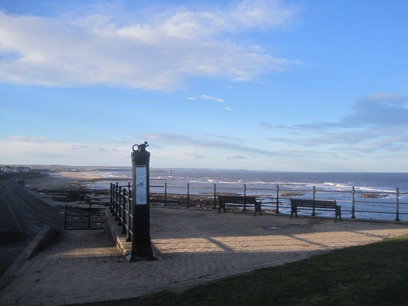
The Hartlepool Story Trail follows a sequence of 18 signs, crowned by a monkey. You’ll see why later. It traces the history of Hartlepool back to AD640, highlighting local landmarks along the way.
It’s a walk that I often do, paying no particular attention to the signs because my eyes are focussed on the sea. Hartlepool’s history is irretrievably mixed with the maritime and the walk starts midway along the promenade. Why, I really don’t know!
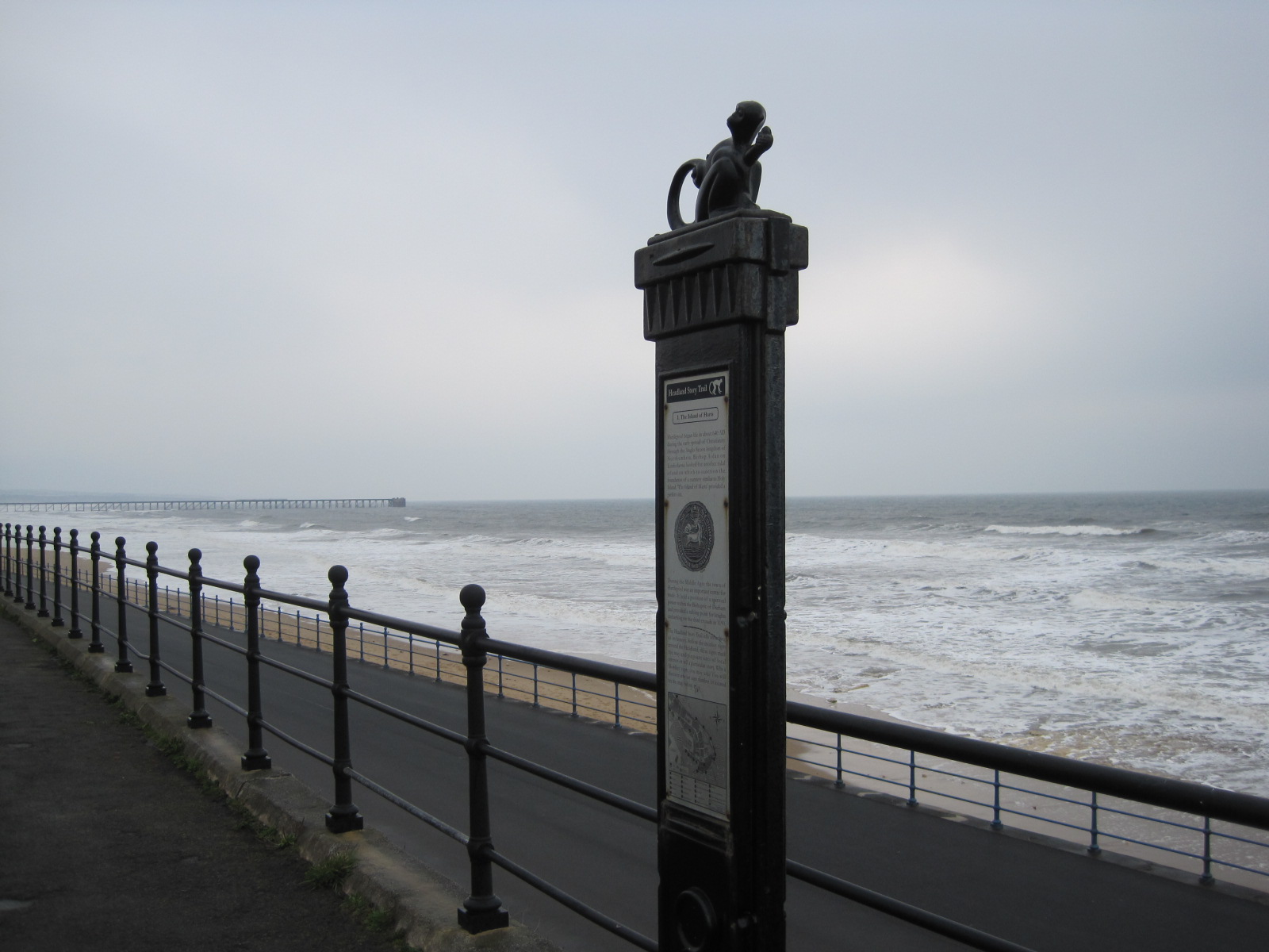
No. 1- the ‘Island of Harts’
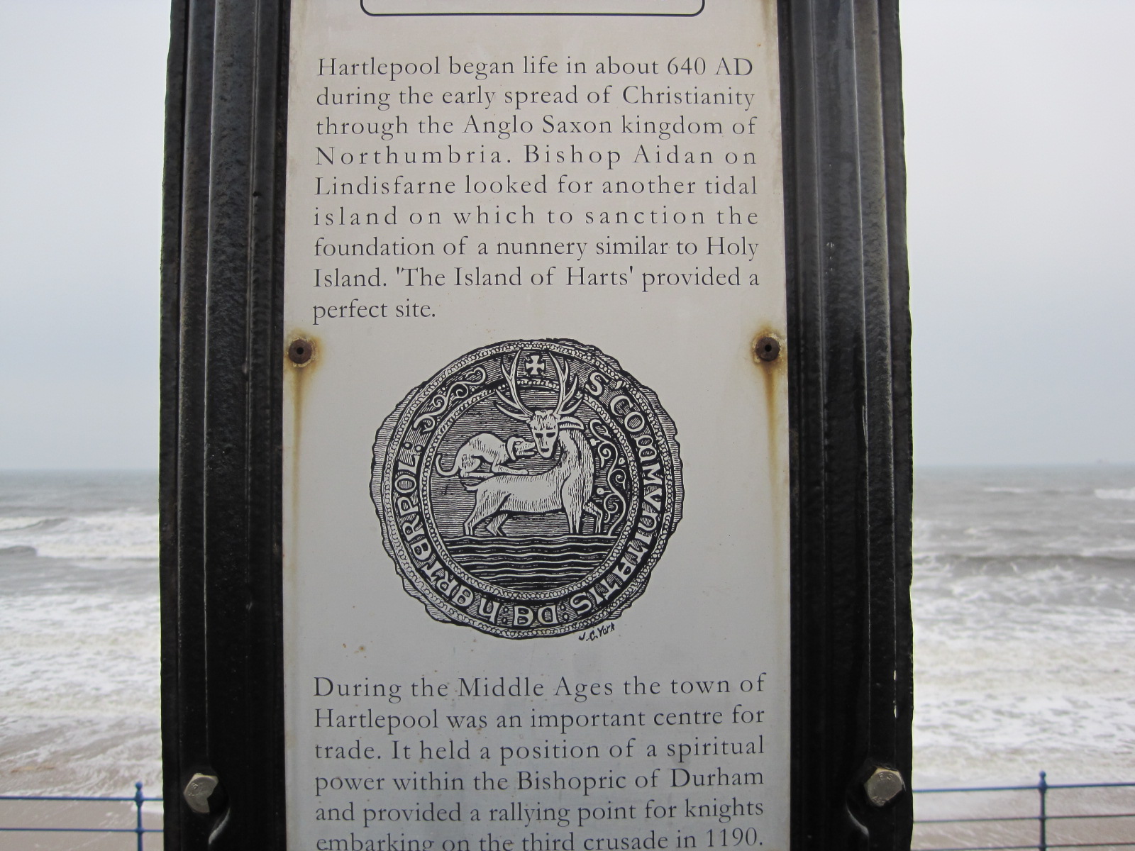
The hart is a symbol of Hartlepool and appears throughout the town
It will be fairly obvious, I think, that I took some of these photos on different days. The sea is always a magnet to me, whether it’s thundering against the sea walls or softly licking the shore.
No. 2- ‘Fairy Cove’

A calm blue background for the monkey
This point marks the north eastern end of the town wall. The ‘Fairy Coves’ were man-made circular excavations, 5 metres in diameter, about 12 feet above the shore, and intended as ‘places of concealment’ for humans.

No. 3- Beacon and Town Moor
Today’s beacon, on a bluer day!

No. 4- Bandstand & Elephant Rock

Elephant Rock, which collapsed in 1891
- The bandstand still exists, though in rather dilapidated condition. Gone are the days when it witnessed street theatre, boxing matches and even motor bike racing time trials. Elephant Rock, sadly, is no more, but there are still numerous smaller stacks along the shoreline.
-
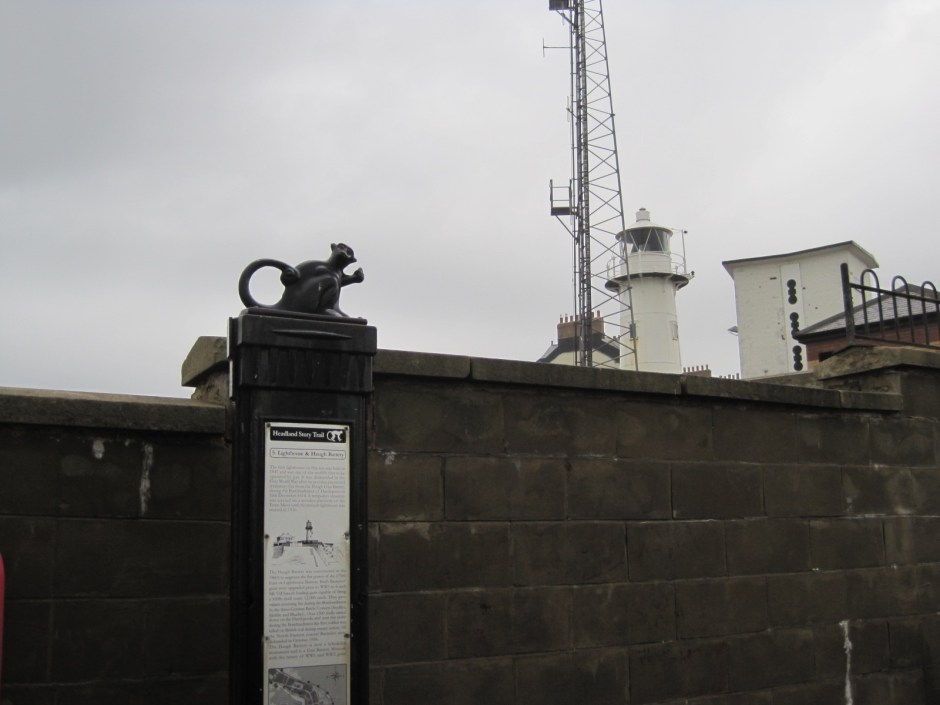
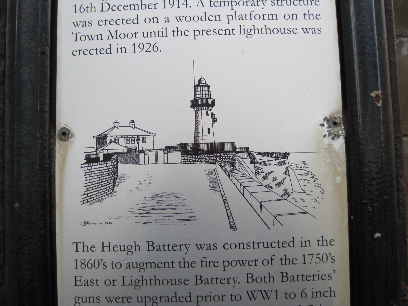
No. 5- Lighthouse and Heugh Battery
The first lighthouse on this site dates from 1847 and was one of the world’s first to be operated by gas. It was dismantled during the First World War because its position prevented retaliatory fire from the Heugh Gun Battery, in the Bombardment of Hartlepool on 16th December, 1914.

The current lighthouse dates from 1926

You may have noticed the darkening sky, and my wonky photo, above. Rounding the lighthouse one day last week, I was met by a storm of hailstones, and this! Happily I wore a waterproof.
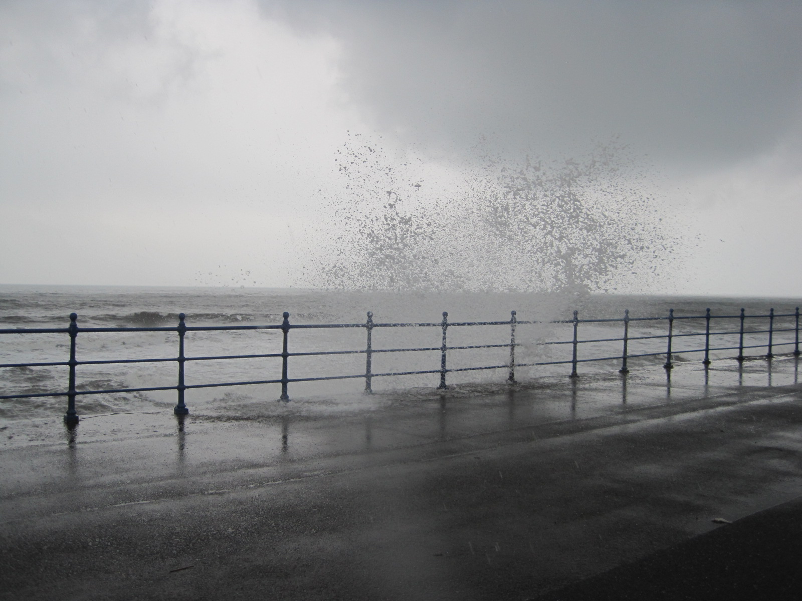
The sea was having fun!
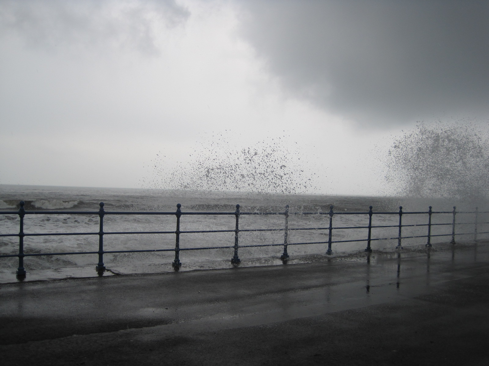
Lots of fun! These photos are not in black and white.
As the sea lashed the promenade, I made a dash for the next sign, no.6- Cliff Terrace.
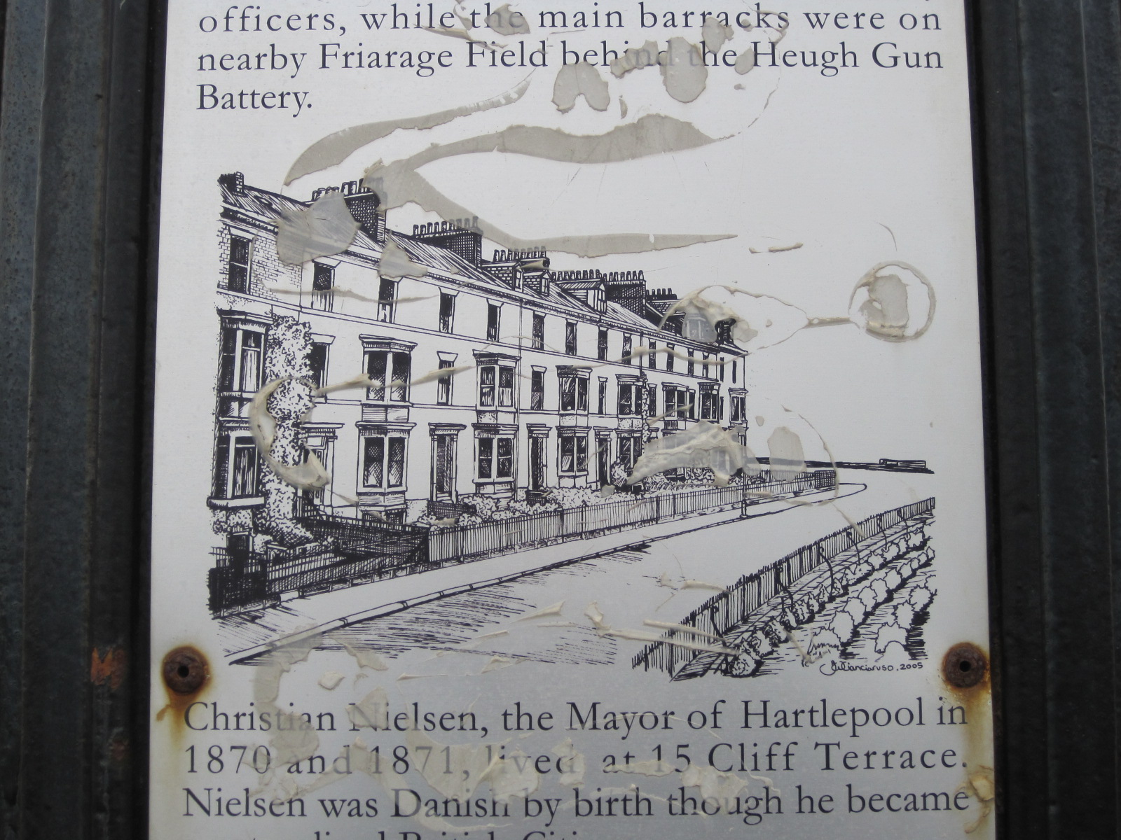
Some of the signs are quite weather worn. It’s no wonder!
No. 7, just off the seafront and a little more sheltered, rather strangely comes in two parts- ‘a’ and ‘b’. Billy Purvis, the subject of 7a and something of a jester, is buried in the grounds of nearby St. Hilda’s Church.
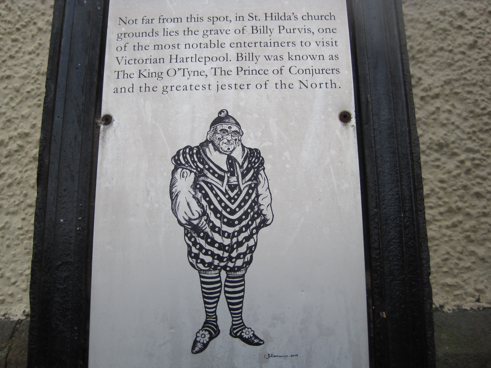
No. 7a- Billy Purvis

7b of course, is St. Hilda’s church, dating from 1190.
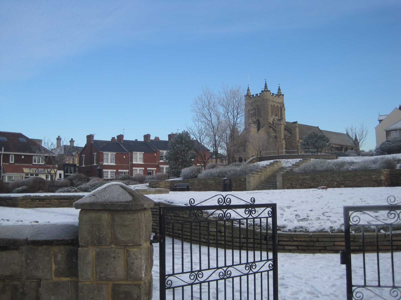
Pretty in snow, isn’t it?
So far this year, there’s been no snow in the north east. Hush! Don’t even think about it. Neither has it been paddling pool weather, but that’s where we’re going next.
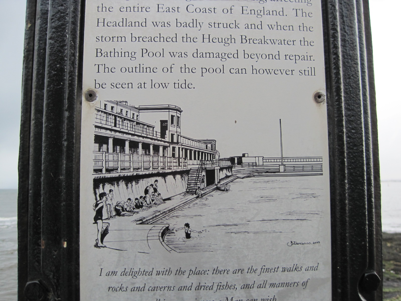
No. 8- the ‘Paddling Pool’
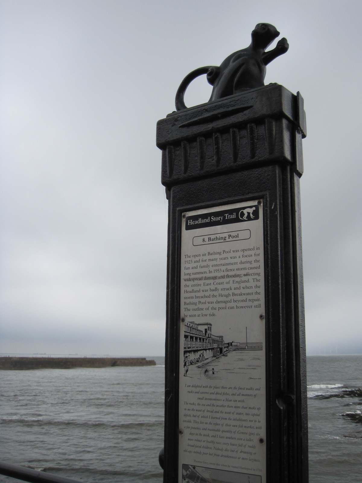
One chilly monkey! What’s that saying? Brass monkeys?
As the sign says, we once boasted a handsome paddling pool set into the rocks beneath this promenade. I dimly remember it from my childhood, but in 1953 a tremendous storm hit the north east coast, and the damage was irreparable. There is a much tamer version of the paddling pool set into the lower promenade, and it continues to delight small persons in Summer.

No. 9- ‘Hartlepool Lifeboats’
Unthinkable that we could have a town without a lifeboat, and one has been in existence since 1803. The first cost just £300 to build locally, and was propelled by 10 oars.

No. 10- ‘Fish Sands and the Monkey’
This is a crucial sign, and the one I started this post with, seen here on a hazy summer’s day. The sign includes the tale of the monkey-hanging, which no self-respecting Hartlepudlian can fail to know, though it doesn’t reflect well on us. Allegedly, during the Napoleonic Wars, a severe storm hit a French vessel off the coast of Hartlepool. Following the wreck of the ship a sole survivor, a nautically attired monkey, was washed ashore on the Fish Sands. Being unfamiliar with monkeys and naturally suspicious of the French, the people of Hartlepool decided to hang this “Frenchman” as a spy, and have been trying to live it down ever since.
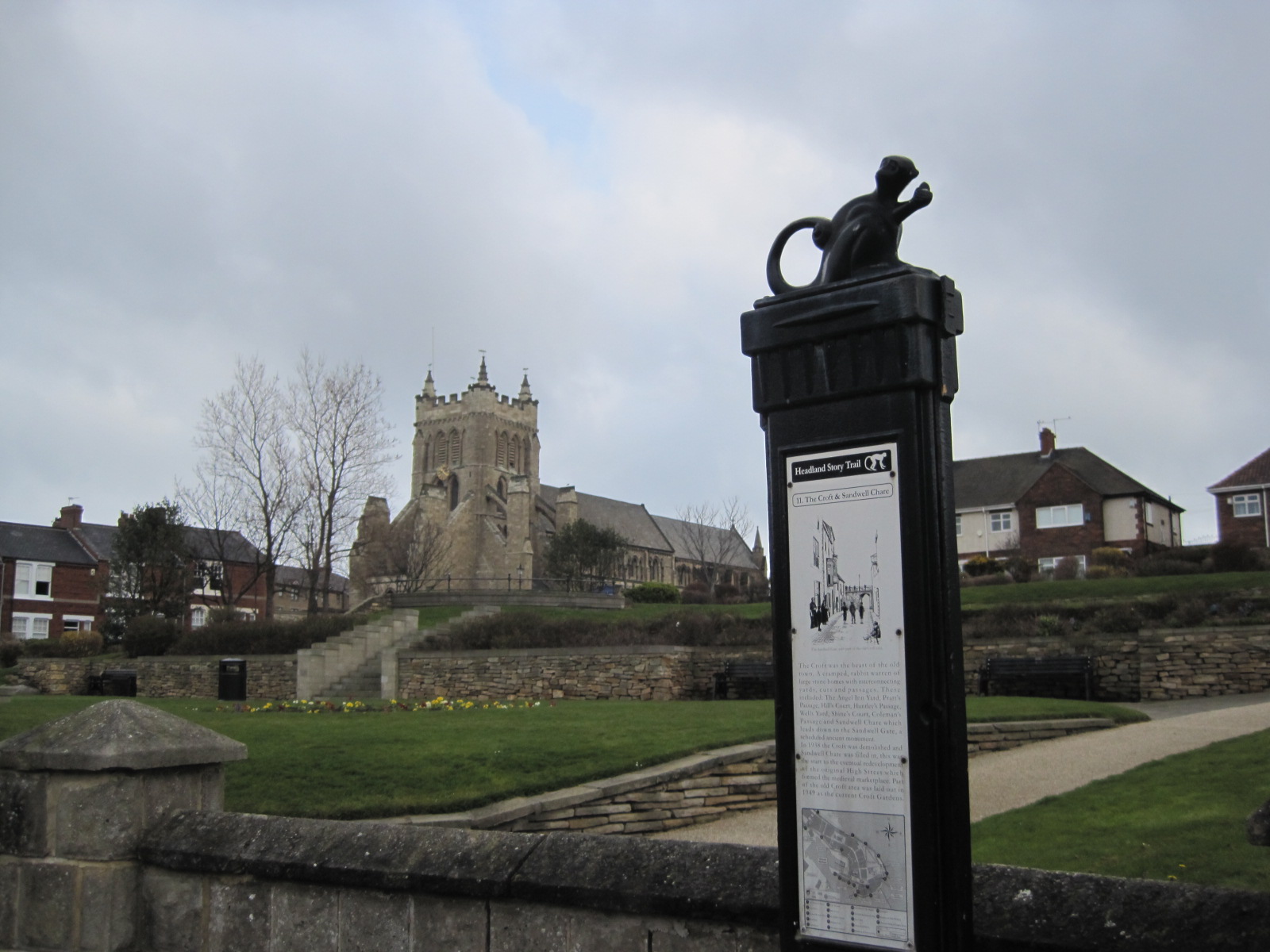
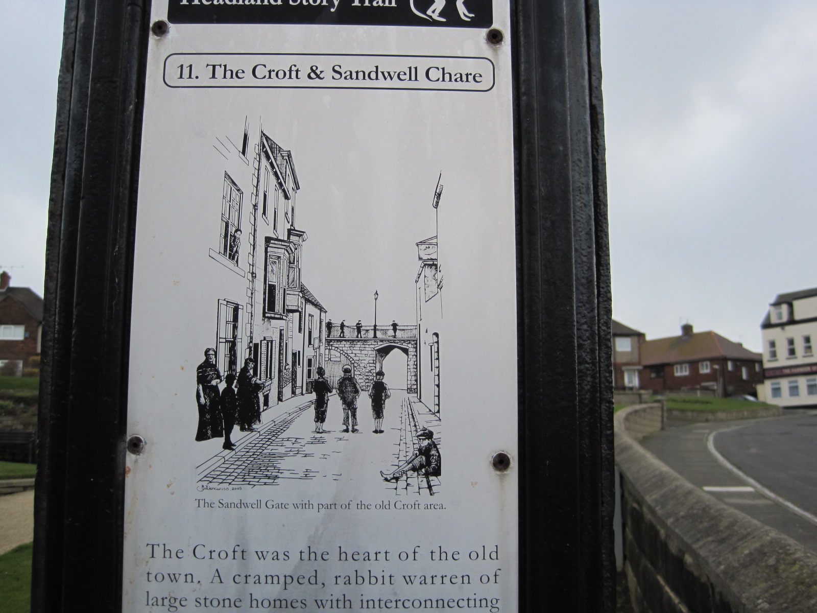
No. 11- ‘The Croft and Sandwell Chare’, with St. Hilda’s in the background
Sandwell Gate, leading to the beach- the prettiest bit of the town wall
The Croft Gardens now sit below St. Hilda’s Church (but beside Verrill’s Chip Shop- another famous landmark!) This was the site of the former old town, which was demolished in 1938.
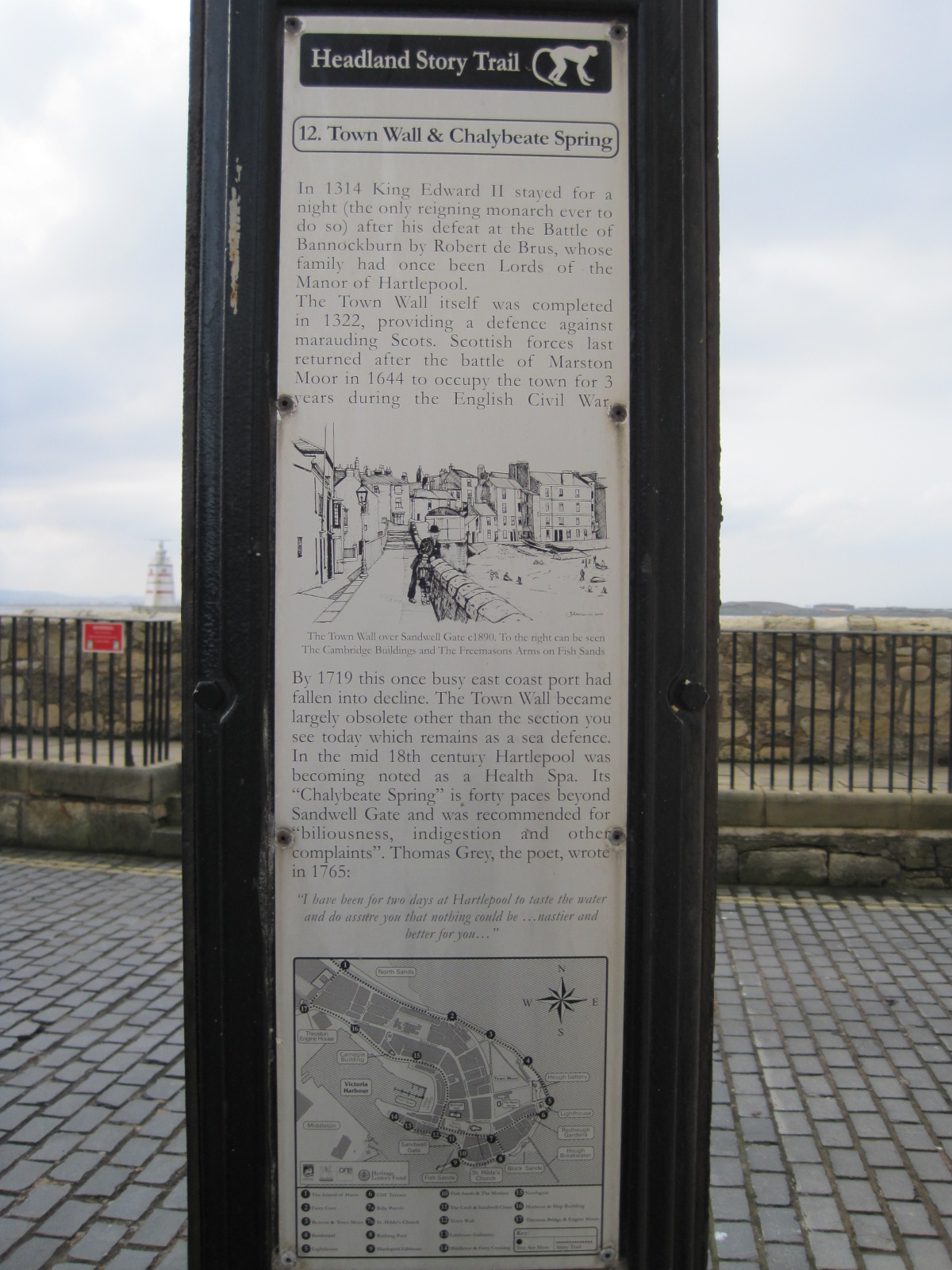
No. 12- ‘Town Wall and Chalybeate Spring’
Amazing to think that our pretty Town Wall, which has often been admired as my former header, has stood firm against elements and enemies since 1322. ‘Chalybeate Spring’ was a thriving Health Spa, said to cure indigestion and other ailments. Must have been the bracing sea air!

No. 14- ‘Middleton & Ferry Crossing’
Sadly I don’t remember the ferry, which stopped running in 1952, but I well remember Middleton and the dockland area.
The alert amongst you may have noticed a leap in the signs. No. 13 is absent because I simply couldn’t find it! Having got this far, in spite of inclement weather, I decided to terminate the walk. I already have more information than you can readily digest and I don’t want to bore.
If you are interested and stop to read every one of the signs, the walk will take you no more than an hour or two. There’s a map at the bottom of each sign so you can’t get lost. On a nice day there are plenty of spots to linger and just watch the sea, and the boats heading for harbour. If it rains I could recommend you to Mary Rowntree’s tearooms. A former chapel, it has been beautifully converted, and you will pass it on your route. Or you may be lucky enough to find St. Hilda’s open, and step inside. For background history, if you can’t get here, this is an excellent article.
So what did you think of this week’s walk? And, more importantly, do you have a walk you’d like to share with me? If you do, I’d be delighted if you could leave a link in the comments below. Or even link back to me from your post, if it’s a new one. I look forward to an evening’s reading.
You can join in too!
http://shareandconnect.wordpress.com/2014/03/31/jos-monday-walk-longwood-gardens/
http://smallbluegreenwords.wordpress.com/2013/03/12/strolling-around-the-ile-de-la-cite/
http://poppytump.wordpress.com/2014/03/31/clouds/
http://sonelcorner.wordpress.com/2014/04/01/jos-monday-walk-schoemansville-oewerclub/
http://55daysinwarsaw.wordpress.com/2013/09/17/a-walk-in-warsaw-rain/
http://morselsandscraps.wordpress.com//?s=Return+to+the+headland
http://morselsandscraps.wordpress.com//?s=A+photo+stroll+Sydney+CBD

You must be logged in to post a comment.